Overview
- Days: 5
- Fitness Level: Challenging
Details
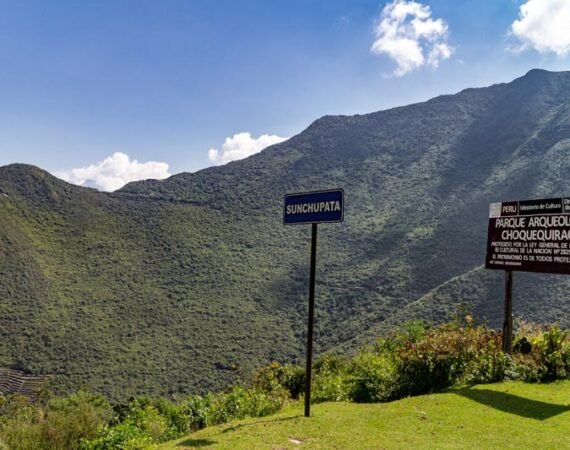
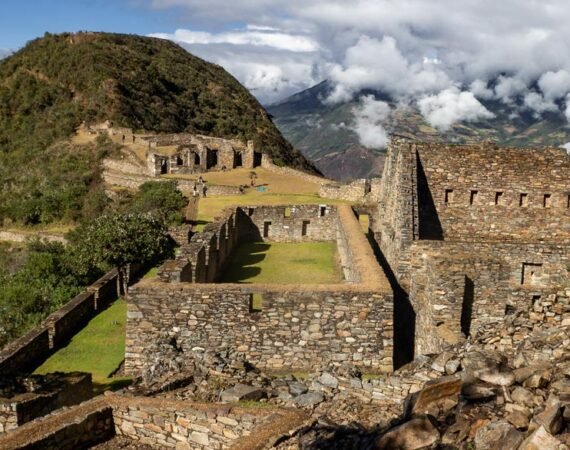
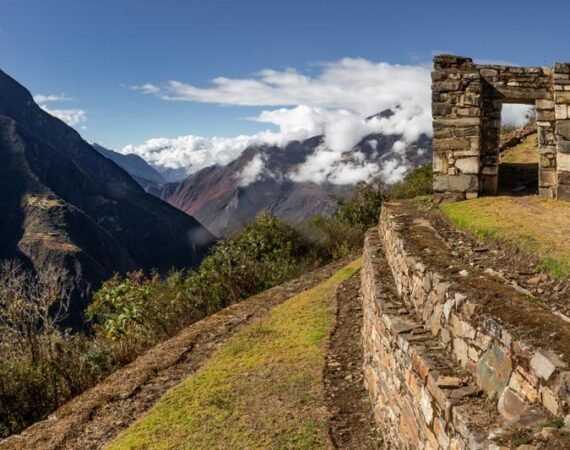
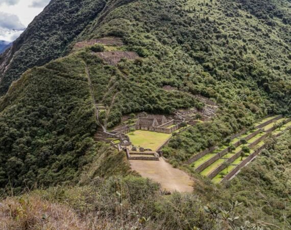
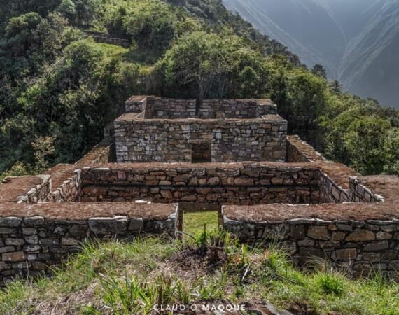
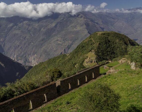
A rival to Machu Picchu in terms of its size and splendor, more buildings and llama-embellished terraces are being revealed in Choquequirao each year. Choquequirao is more difficult to access and much less visited than Machu Picchu. Our trek to the so-called ‘Cradle of Gold’ in Peru is accessed by way of the awe-inspiring canyon of the Apurimac River, involving a descent and subsequent ascent of almost 2000 meters to reach our camp beside the citadel of Choquequirao.
Throughout our journey we work exclusively with local people who provide us with food and shelter, all of which is grass-roots and fair-trade. We use local horses to support the Andean economy, plus our guides speak Quechua and are able to facilitate translations between English speakers and the local community. By using local horses to carry our luggage through the mountains, we assure you are in for an authentic experience!
Written by: Ernest Goddard (Client served by Inkati)
Choquequirao, which means “Cradle of Gold”, is a magnificent archaeological complex located in the Vilcabamba mountain range in the Cusco region. It is believed that this mountain range was the last refuge of the Incas, who resisted the Spanish conquest, led by Manco Inca II.
On our trip, we will be able to enjoy spectacular landscapes typical of the Andean geography. The flora and fauna, the pluvial systems, the inter-Andean valleys, the tropical jungle and the local people enrich the experience of life in this adventure.
The temperature on this trek can range from a minimum of -5ºC at night, and a maximum of 25ºC during the day depending on the area.
Thanks to our extensive experience, we have designed this program to make the most of this incredible adventure.
Day by Day
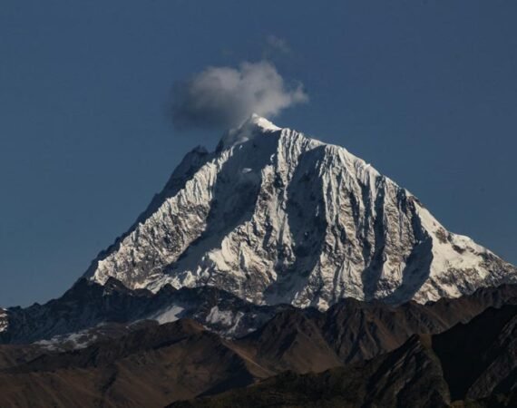
We leave from Cusco around 6am, arriving at the village of Cachora in approximately 5 hours. Arriving at Capuliyoq we organize our equipment on mules and horses, and after lunch we start the hike. On the way we can appreciate the majestic, snowy peaks of Padrayoc and Wayna Cachora, while in the distance it is possible to appreciate the path that will be followed for the first day and second day.
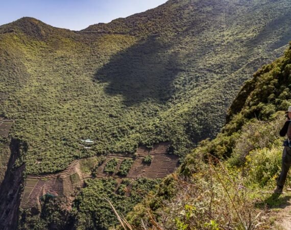
We begin the descent through a zigzagging path, crossing the imposing Apurimac Canyon. After approximately four-hours, we will arrive at our first camp called Chiquisca (1,930 m/ 6264 ft). We can expect a warm night in the valley. L,D
TREK LOG. 5.3 mi /8.53km. Cumulative ascent 285ft/87m. Cumulative descent 3622ft/1014m. Maximum altitude 9815ft/2993m. Campsite 6155ft/1877m.
After breakfast, we descend to Playa Rosalina (1550m), where we pass a checkpoint and cross the bridge over the Apurimac River. The time to this point will be approximately 1 hour.
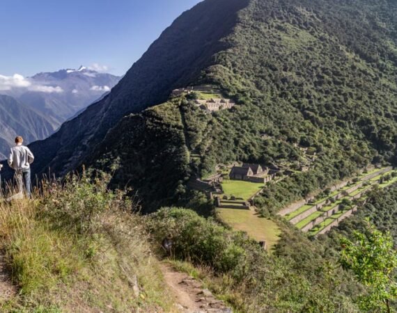
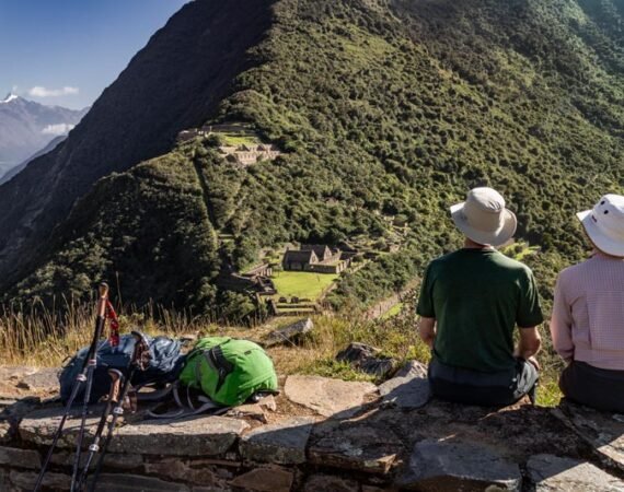
We begin our ascent by zigzagging along the path to Santa Rosa (2095m), where we can take a refreshing break. We continue the hike to Marampata (2850m), a flat place where we can rest in similar conditions to Santa Rosa, enjoying a splendid view over Choquequirao. The ascent time from the Apurimac River to Marampata is approximately 4 to 5 hours. The gradient varies from almost flat to very steep. B,L,D
We follow the trail between flat parts with small ups and downs to reach our campsite in Choquequirao. This campsite has toilets and a cold-water shower.
TREK LOG: 6.4 mi /10.3km. Cumulative Ascent 4800ft/1464m. Cumulative Descent 1370ft/418m. Max elevation 9540ft/2906m.
We start the day with a delicious breakfast, then we have enough time to enjoy the majesty of this archaeological zone. We can appreciate houses, terraces and other parts of this Inca citadel. We will also have the opportunity to visit the terraces, decorated with llama stonework, right at the top of the Apurimac canyon. It is also possible to see the flight of the majestic andean condor, as these areas are part of its extensive habitat.
In the afternoon we can see the area that is in the process of excavation, and unexplored areas that can give us more understanding of the last refuge of the Incas. B, L, D
TREK LOG: 5.4 mi /9.3km. Cumulative ascent 1263ft/385m. Cumulative descent 1440ft/439m. Max elevation 10,024ft/3122m.
Today after the breakfast we start our journey back taking the same way until playa Rosalina where our crew and chef will be waiting for us with a delicious lunch, after some resting time we continue the ascending trail to Chiquisca campsite. B, L, D
TREK LOG: 6.4 mi /10.3km. Cumulative Ascent 1370ft/418m Cumulative Descent 4800ft/1464m. Max elevation 9540ft/2906m.
We begin the day as early as it´s possible to avoid the midday sun, which is exhausting. After an early breakfast you will get ready to return to Cusco. It would take around 4 hours uphill to the end of the trek, where you´ll enjoy your last lunch with your guide and the crew.
Say goodbye to your team other than your guide and then continue for around 4 hours by car, drive back to Cusco along the nice landscapes. B, L
Extra option: Hot springs in Cconoc to relax after the several days of hiking.
TREK LOG: 8 Km. / 4.9 mi Hiking time: 4 to 5 hours approximately. Maximum Altitude: 2900 m / 9514 ft Minimum Altitude: 1860 m / 6102 ft
General Information
- Transportation.
- All meals.
- Camping Equipment.
- Tickets to all sites.
- Bilingual guide in Spanish and English.
- Insurance.
- Tips for staff.
- Food not mentioned.
- Flashlight with spare batteries.
- Waterproof jacket/rain poncho.
- Passport.
- Comfortable hiking boots.
- Wicking/Hiking Shirt & hiking pants.
- Hat for the sun.
- Mosquitoes Repellent
- Sunblock cream, +50 recommended.
- Bathing suit for hot springs (Aguas Calientes).
- Personal medication.
- Camera with spare batteries.
- Battery bank (useful for hikes).
- Cash in soles for souvenirs, extra food and drinks and tips.
Sustainable Travel
Low-impact Tours
On this program we strive to preserve and protect delicate routes and natural habitats in order to not enhance mass-tourism in remote areas and minimise the effects of our presence in such areas. We therefore choose routes for the program that are specific for Tourism and trekking and avoid exploring remote places.
Cultural Awareness
It generally works best when there is smaller scale, slower growth, and greater involvement by our local communities in all steps of the tourism development process. We work mainly with small business and communities ensuring that most of the profit benefits actual people, and not just big organizations.
Gallery
Recommended Tours
DOWNLOAD THIS TOUR
INQUIRE OR BOOK THIS TOUR
Do you want inquire further about this trip, talk with us or simply book this trip?

